
About
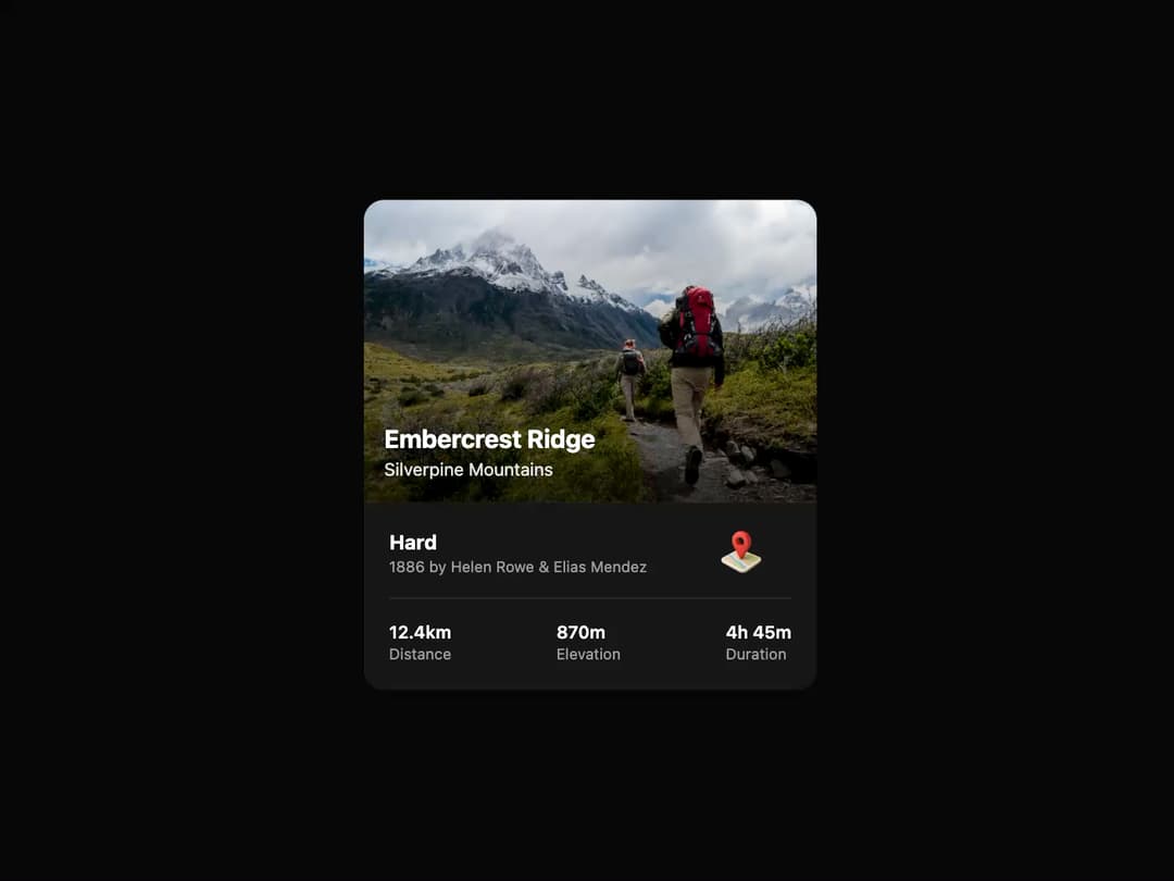
Trail Card A visually polished card component to display trail or location information, featuring a prominent image, key stats, and an interactive call-to-action. It includes a subtle hover animation for a modern feel.
Built with React and Tailwind. Copy the prompt and paste it into Claude Code, Cursor or Lovable: your agent adds Trail Card to your project and fits it to your theme.
Code
How Trail Card is used: the demo's code. The component's own source comes with a free account.
Usage.tsx
// demo.tsx
import { TrailCard } from "@/components/ui/trail-card";

export default function TrailCardDemo() {
  return (
    <div className="flex min-h-screen items-center justify-center bg-background p-4">
      <TrailCard
        title="Embercrest Ridge"
        location="Silverpine Mountains"
        difficulty="Hard"
        creators="1886 by Helen Rowe & Elias Mendez"
        distance="12.4km"
        elevation="870m"
        duration="4h 45m"
        // Using a placeholder image service for demonstration
        imageUrl="https://cdn.21st.dev/assets/mirror/5c/5c94637fd7e76954b66898cf5f8ec3f5a7aec24e1fe09940e5edd56234032a32.jpg"
        // A placeholder for the map SVG/image
        mapImageUrl="https://www.thiings.co/_next/image?url=https%3A%2F%2Flftz25oez4aqbxpq.public.blob.vercel-storage.com%2Fimage-3JYNLpogg5zknunPABpdOpEjJmZN5R.png&w=320&q=75"
        onDirectionsClick={() => alert("Directions clicked!")}
      />
    </div>
  );
}
Dependencies
More by Ravi Katiyar
View all

Animated Shader Hero
3.7K
Hero
3.1K
Circular Gallery
2.7K
Minimalist Hero
2.5K
Floating Icons Hero Section
1.9K
Glass Calendar
1.8K
Feature Carousel
1.7K
AI Image Generator Hero
1.4K
More in Cards
View all

Statistics Card 2
264

Course Design Cards
1.1K
Card
70
Stats cards with links
39
The Item one
3

Card Studio
7
Statistics Card 7
292

Item
10
